The opinion that all geographical discoveries have long been made and geographers have nothing to give to the world is wrong.
Indeed, the great geographical discoveries that brought the world knowledge about new continents, large rivers, mountain ranges and countries occurred before the 20th century. But even in the XX-XXI centuries, researchers continue to amaze the world with the discovery of unexplored places on our planet, only the quality and nature of these discoveries have changed. Long-distance travels across the seas and continents were replaced by viewing and analyzing space images at the desk. At the service of geographers are now the methods of geophysics and geochemistry, aerial photography, radar photography from special satellites. The very concept of "geographical discovery" has expanded and now includes not only the study of land and water depths, but also air, because modern geography is obliged to identify the laws and patterns that govern each geographical component and their relationship with each other.
It was in the 20th century that it became possible to determine the exact position of the North and South Poles (1909-1911). Thanks to images from space, geographers managed to spatially orient objects (mountains, rivers), give them a coordinate base and clear references. Already well-known rivers and lakes are the object of close research by geographers, because many of them have changed their course and moved hundreds of kilometers away from each other and from the water bodies into which they used to flow (this trend is observed in the Aral Sea and the Caspian Lake).
Through space photography, many new high-altitude lakes in the Himalayas and a mountain range in Antarctica covered with a half-kilometer layer of ice have been discovered (2009). These mountains, reminiscent of the Alps in their territory and height, but 10 times older than them (the Alps are about 50 million years old), rise up to 3 thousand kilometers, and even geographers did not know about their existence.
New technologies have allowed geographers to approach from a different point of view long-explored areas of the Earth, and this made it possible to discover cyclic multi-kilometer circles-cavities - nuclear structures. Their study leads scientists to believe that the Earth was once riddled with huge craters and resembled the surface of the Moon.
Other geographical events of the 20th century also changed the map of the world: the discovery of the islands of Severnaya Zemlya (in 1913), the glaciers of the Polar Urals (1925), Taimyr (1970) and Suntar-Khayat (1932), the valley of geysers on the Vitim River (Siberia, in 1983). The 20th century was also marked by discoveries in the World Ocean: new knowledge changed the ideas of geographers about the bed of the Indian and Atlantic oceans, in 1948 the Lomonosov and Mendeleev mountain ranges (Arctic Ocean) were discovered.
Remained on the world map are areas that have not yet been visited by man and are waiting for their discoverers, for example, the mountains of the Hindu Kush and the Himalayas, distant regions of Antarctica, the wilds of the Amazon. There are many tribes and nationalities left on Earth, about which mankind has the most vague ideas: the modern world knows nothing about their language, culture, customs. These include the Sentinelese, who live in the Bay of Bengal on an island between Thailand and India. Anthropologists consider them to be the progenitors of our civilization, who left Africa 60 thousand years ago. The discovery of new species of flora and fauna is constantly taking place in the most mysterious country of Papua (New Guinea).
A significant world geographical event was the discovery by Russian scientists of the subglacial Lake Vostok (named after the research station "Vostok", which was located on it) in Antarctica. According to rough estimates, the lake is a million years old and during this time it has never come into contact with atmospheric air, being securely covered by a 4-kilometer thick layer of ice. Is there life in the lake? What happens if lake water comes into contact with air? How to take water samples in such a way that water does not come into contact with the modern atmosphere? Behind all these questions lie future discoveries. By studying water samples, scientists hope to accurately reconstruct Earth's climate, chemical composition and atmospheric properties even before glaciers appeared. If living organisms are found in the lake (and the conditions are quite suitable: + 10 ° C and the most powerful oxygen saturation of water is 50 times higher than on the surface of the Earth) - this will become another geographical discovery.
The era of great geographical discoveries had a huge impact on the development of all mankind. The discovery of new lands, trade routes and more convenient sea routes made it possible to develop trade and social relations between countries and continents, develop many sciences, and expand people's understanding of the structure of the world.
Prerequisites for great geographical discoveries
Throughout history, many geographical discoveries have been made, but only those that were made at the end of the 15th - beginning of the 16th century entered world history as the Great ones. This is explained by the fact that neither before nor after this period, no one was able to repeat the success of medieval discoverers and make such large-scale discoveries.
At the turn of the 15th-16th centuries, brave navigators managed to discover previously unknown lands for the entire Western world - South Africa and America, find new ways to Japan, China, Indonesia, swim across the Pacific Ocean, conquer the harsh polar waters.

Rice. 1. Sea travel.
Travelers of that time had not only the desire to make discoveries, but also all the means to achieve their goal:
- fast sailing ships;
- devices that helped to navigate in distant sea voyages;
- special navigational charts that facilitated laying courses on the high seas or ocean.
The main reason for the accomplishment of new geographical discoveries was the increased need for new goods, raw materials, more convenient and shorter trade routes.
Western merchants and industrialists saw the possibility of easy enrichment by robbing rich peoples from distant lands. India seemed to many such a magical country, a free and safe path to which ran only through the Atlantic Ocean.
TOP 5 articleswho read along with this

Rice. 2. Indian goods.
Goods from India have been very popular in Europe since ancient times. However, there were no direct trade routes with this exotic country: there were hostile states on the way to India, and trade was carried out through numerous intermediaries. Indian spices, fabrics, gold, jewelry, like a magnet, attracted European travelers.
Great geographical discoveries
The first on the way to the great geographical discoveries were the Portuguese. They were quickly joined by the Spaniards and the British, who also made desperate attempts in search of new rich lands.
However, the great geographical discoveries were made not only by European navigators. There were many brave pioneers in Russia who opened up the vast expanses of Siberia and the Far East to the world.
Table "Great geographical discoveries"
|
opening date |
Traveler |
Perfect discoveries |
|
Bartolomeu Dias |
Opening of a sea route to the Indian Ocean along the coast of Africa |
|
|
Christopher Columbus |
Discovery of a new continent - America |
|
|
John Cabot |
The beginning of the search for a northern route to India. Discovery of the Strait of Labrador |
|
|
Vasco da Gama |
Opening of the sea route to India |
|
|
Pedro Carbal |
Discovery of Brazil |
|
|
Vasca Nuñens Balboa |
Crossing the Isthmus of Panama and opening the Pacific Ocean |
|
|
Ferdinand Magellan |
The world's first trip around the world, during which it was proved that the Earth has the shape of a ball |
|
|
Abel Tasman |
Discovery of Australia and New Zealand |
|
|
Semyon Dezhnev and Fedot Popov |
Opening of the strait between Asia and North America |
Consequences of the great geographical discoveries
New, previously unexplored lands inhabited by completely unfamiliar peoples, seas and boundless oceans amazed the imagination and opened up great opportunities that could not even be dreamed of before.

Rice. 3. Discovery of America.
The most important consequences of the great discoveries include:
- Development of relations and strengthening of ties between different states.
- Development of trade and industry.
- The beginning of the era of colonialism.
- Artificial interruption of Indian civilizations in the New World.
- A leap in the development of the natural sciences.
- Establishment of modern contours of the continents.
What have we learned?
When studying the topic “Table “Great geographical discoveries” in the 7th grade history program, we learned what period the great geographical discoveries belong to and why they entered history under that name. We found out which travelers made the most significant discoveries, and what role they played in the history of mankind.
Topic quiz
Report Evaluation
Average rating: 4.5. Total ratings received: 900.
A huge underground lake, a self-healing pearl, secret mountains as high as the Alps and other discoveries made by Russian geographers over the past 100 years.
By the beginning of the 20th century, there were practically no places left on Earth where a geographer would not set foot: the main continents were more or less studied, and the ideas of contemporaries about the world around were relatively accurately mapped. Thus, there were fewer and fewer "blank spots" for romantic travelers. The latest technologies of geochemistry and geophysics, satellite imagery, and aerial photography came to the aid of the inquisitive mind of the researcher. Thanks to this, the concept of “geographical discovery” has significantly expanded and began to include not so much a visual description as an attempt to explain a geographical phenomenon in its entirety and the totality of patterns that govern each component of nature separately. Nevertheless, the past century will be remembered by us for the most important geographical discoveries, which significantly expanded our understanding of our native home called planet Earth. A conference is being held in Moscow from 4 to 6 June "Practical Geography: Challenges of the 21st Century" dedicated to the 100th anniversary of the Institute of Geography of the Russian Academy of Sciences, which is most directly related to many discoveries of both the 20th and 21st centuries. Arkady Tishkov, Deputy Director of the Institute of Geography of the Russian Academy of Sciences, Corresponding Member of the Russian Academy of Sciences, Professor, Doctor of Geology, member of the Presidium of the Russian Geographical Society, spoke about the most significant of them.
"White spot" the size of half of Europe
In 1926, the Soviet geologist Sergei Obruchev and geographer-cartographer Konstantin Salishchev discovered the Chersky Range in northeastern Siberia. This mountain system has a length of 1500 km across the territory of Yakutia and the Magadan region, and the highest point - Mount Pobeda - is located at an altitude of more than 3000 m.
In parallel, the study of the entire north-east of Russia was going on, which for a long time remained a “blank spot” on the map and concealed amazing discoveries. In area, this territory is equal to half of Europe. The pioneer who studied this area at the end of the 19th century was Jan (Ivan) Dementievich Chersky.
The expedition lasted six months, and its result was the discovery of an amazing mountainous country, which Obruchev proposed to name in honor of its first brave explorer. At the same time, the cold pole of the Northern Hemisphere was transferred from Verkhoyansk to Oymyakon. Now both settlements have this status with an absolute minimum of -67.8 °C and -67.7 °C, respectively.
Pearl of Kamchatka
In April 1941, one of the largest and most amazing world discoveries took place - the Valley of Geysers was found in Kamchatka. The discoverers were geologist Tatyana Ustinova and her local guide Ansifor Krupenin. The area was discovered during the study of the Shumnaya River.
The Valley of Geysers is a canyon of the Geysernaya River, covers an area of 6 km² and consists of a large number of thermal sites, hot springs, mud pots, lakes and even waterfalls. The unique microclimate has led to abnormally high biological diversity in a limited area.

In the year of discovery, a description of all sources was also produced.
In 2007, the valley was destroyed by a mudflow. Masses of soil blocked the Geysernaya River with a dam, and most of the thermal springs were deep under water. Surprisingly, the unique natural object showed an excellent ability to self-heal. Six years later, a repeated mudflow broke through the dam, the valley cleared up, and the number of active geysers even increased. The pearl has become even more beautiful.
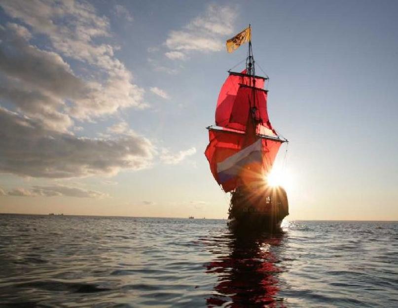
Vostok will tell about the history of the Earth
In February 2012, an event took place that, without exaggeration, had been waiting for decades: in the area of the Russian research station Vostok in Antarctica, scientists drilled almost 4,000 m thick ice and discovered a unique lake hidden from the outside world for 14 million years. The subglacial lake was named Vostok.

The existence of the lake was theoretically predicted in the middle of the last century, and the hypothesis was confirmed in 1996. The discovery of the century has led to the emergence of a large number of new questions, the answers to which will be sought by researchers of the 21st century. Are there living organisms in the lake? What happens when lake water comes into contact with the modern atmosphere? Are ancient bacteria dangerous for humanity?
Thus, it can be confidently asserted that geographical discoveries, which will allow, among other things, to restore the history of climate change on Earth, are still ahead.
Mountains in Antarctica
Previously, it was believed that the landscape of Antarctica is a plain without distinct geological formations. However, in 1958, researchers were in for a pleasant surprise. The Third Soviet Antarctic Expedition discovered a whole system of ice mountains in the central part of East Antarctica. They were named after the Soviet geophysicist and academician Grigory Gamburtsev. The dimensions of the mountain formation practically coincide with the European Alps: the length is about 1300 km, the width is from 200 to 500 km, the highest known points are 2990 and 3390 m. And all this is under the ice cover, the maximum thickness of which reaches 4000 m!

The Gamburtsev Mountains formed 1 billion years ago. The discovery of this mountain range is extremely important for understanding the processes of formation of the Earth's southern ice sheet. According to modern paleontological theories, the East Antarctic Shield, which now dominates territorially in Antarctica, was formed 33-35 million years ago. He not only hid the Gamburtsev mountains under him, but also gradually covered the entire continent with a multi-meter layer.
Mountains in the ocean
If the Gamburtsev Mountains were under a layer of ice, then the Lomonosov and Mendeleev ridges, discovered by Soviet high-latitude expeditions in 1948 and 1949, respectively, were hidden from researchers by the waters of the Arctic Ocean.
The Lomonosov Ridge passes almost through the North Pole, its length is about 1800 km, the width varies from 60 to 200 km, the height above the ocean floor is from 3300 to 3700 m, the minimum height of the water layer above the ridge starts at 900 m. The Mendeleev Ridge has a slightly more complex story. It is separated by an underwater valley up to 2700 m deep, and the name "Mendeleev Ridge" refers only to the part that is closer to the territory of Russia.
 Installation of the Russian flag made of titanium at the bottom of the Arctic Ocean
The discovery of half a century ago has suddenly attracted attention in our days. The Russian Federation submitted an application to the UN Commission, which argued the need to establish new boundaries of the Russian continental shelf due to the fact that the Lomonosov and Mendeleev submarine ridges are a continuation of the Eurasian continent.
The history of mankind has many important events, for example, the great geographical discoveries (VGO) played an important role in the history of mankind.
First of all, the data on the geography of the entire territory of the planet changed, new maps were compiled.
Why are great geographical discoveries called great? First of all, because these events led to the establishment of relations between states, as well as the expansion of their territories.
Perhaps not everyone knows the most interesting facts about the outstanding discoverers and navigators. How were the discoveries of new lands? Let's figure it out!
Beginning of the Age of Discovery
Before considering the course of the WGO, it is necessary to understand the underlying causes. There are 2 main reasons: the crushing of feudal estates (the ruin of their owners) and the increase in the treasury of the rulers.

Conventionally, the VGO is divided into two stages: European (15-16 century) and Russian (16-20 century).
The European period included:
- discovery of America;
- sea route to India (who was the first to discover India - we will present below);
- exploration of the Pacific Ocean (discovery of Russia by Europe).

Discovery of Alaska by Russian travelers (Vitus Bering and Alexei Chirikov)
During the Russian period, the following events took place:
- exploration of North America and Australia;
- development of the north of Europe and Asia;
- exploration of the Pacific.
Below we consider in detail each of the periods, as well as learn many interesting facts. For example, who was the first to reach China or who was the first to circumnavigate Africa.
Great travelers and their geographical discoveries
In the presented table, you can see the names of travelers, the dates of discoveries, what exactly happened in that period of time.
| Traveler | the date | Opening |
| Marco Polo | 1266 | The first to reach China. He wrote "The Book of the Diversity of the World", which subsequently made a great impression on many travelers. |
| Bartolomeu Dias | 1488 |
|
| Christopher Columbus | 1492 | America is open. Everyone remembers that Columbus mistook America for the shores of southern India. In 1501, Vespucci discovered Brazil and the mainland of South America, which he named after Columbus (pioneer). |
| Vasco da Gama | 1498 | He was the first to discover India, the first to circumnavigate Africa. |
| Vasca Nuñens Balboa | 1513 |
|
| Ferdinand Magellan | 1519 - 1522 |
|
| Abel Tasman | 1642 - 1643 |
|
Discoveries of Russian travelers
The table contains data on Russian travelers, the dates of events are recorded, and a brief description of what is happening in that period of time is given.
| Traveler | the date | Opening |
| Sergei Dezhnev | 17th century |
|
| Ivan Moskvitin | 1639 | The Pacific coast is open. |
| Vitus Bering and Alexey Chirikov | 1725 – |
|
| Ivan Kruzenshtern and Yuri Lisyansky | 1803 - 1806 |
|
| Thaddeus Bellingshausen and Mikhail Lazarev | 1819 | Discovery of the islands of Antarctica. |
| Gennady Nevelskoy | 1849 - 1855 |
|
| Petr Petrovich Semenov-Tyan-Shansky | 1856 |
|
| Nikolai Przhevalsky | 1870 - 1880s |
|
| Boris Vilkitsky | 1910 – |
|
The latest geographical discoveries of the 21st century
Contemporaries discover the secrets of the last century. Therefore, most of the expeditions explore the territories and waters of Antarctica, the Canary Islands, the waters of the Amazon, the islands between the two continents of America and the Arctic Ocean.

The Gamburtsev Mountains (Antarctic Alps) is an ancient mountain system in Antarctica. They were discovered in 1958 by Soviet researchers, but remained unexplored for a long time due to inaccessibility.
Consequences of the Great Geographical Discoveries
Discoverers, travelers and navigators have made a huge contribution to the history of mankind:
- new lands and countries were discovered;
- new trade routes appeared;
- with the help of VGO, the economy acquires a multifaceted character;
- colonization led to a mixture of religions, socialization of different cultures. Science begins to develop all over the world;
- the population increases and there is a mixture of races.
Without the Russian pioneers, the map of the world would be completely different. Our compatriots - travelers and navigators - have made discoveries that have enriched world science. About the eight most notable - in our material.
Bellingshausen's first Antarctic expedition

In 1819, the navigator, captain of the 2nd rank, Thaddeus Bellingshausen led the first Antarctic expedition around the world. The purpose of the voyage was to explore the waters of the Pacific, Atlantic and Indian oceans, as well as to prove or disprove the existence of the sixth continent - Antarctica. Having equipped two sloops - "Mirny" and "Vostok" (under the command), Bellingshausen's detachment went to sea.
The expedition lasted 751 days and wrote many bright pages in the history of geographical discoveries. The main one - - was made on January 28, 1820.
By the way, attempts to open the white mainland were made earlier, but did not bring the desired success: there was not enough luck, or maybe Russian perseverance.
So, the navigator James Cook, summing up his second circumnavigation, wrote: “I went around the ocean of the southern hemisphere in high latitudes and rejected the possibility of the existence of the mainland, which, if it can be found, is only near the pole in places inaccessible to navigation.”
During Bellingshausen's Antarctic expedition, more than 20 islands were discovered and mapped, sketches of Antarctic species and animals living on it were made, and the navigator himself went down in history as a great discoverer.
“The name of Bellingshausen can be directly put on a par with the names of Columbus and Magellan, with the names of those people who did not retreat before the difficulties and imaginary impossibilities created by their predecessors, with the names of people who went their own way, and therefore were the destroyers of barriers to discoveries, by which epochs are designated, ”wrote the German geographer August Petermann.
Discoveries of Semenov Tien-Shansky

Central Asia at the beginning of the 19th century was one of the least explored areas of the globe. An indisputable contribution to the study of the "unknown land" - as geographers called Central Asia - was made by Peter Semenov.
In 1856, the main dream of the researcher came true - he went on an expedition to the Tien Shan.
“My work on Asian geography led me to a detailed acquaintance with everything that was known about inner Asia. In particular, the most central of the Asian mountain ranges, the Tien Shan, beckoned me to itself, on which the foot of a European traveler had not yet set foot and which was known only from scarce Chinese sources.
Semenov's research in Central Asia lasted two years. During this time, the sources of the Chu, Syrdarya and Sary-Jaz rivers, the peaks of Khan-Tengri and others were put on the map.
The traveler established the location of the Tien Shan ranges, the height of the snow line in this area and discovered the huge Tien Shan glaciers.
In 1906, by decree of the emperor, for the merits of the discoverer, they began to add a prefix to his surname - Tien Shan.

Asia Przewalski

In the 70s-80s. XIX century Nikolai Przhevalsky led four expeditions to Central Asia. This little explored area has always attracted the researcher, and traveling to Central Asia was his old dream.
Over the years of research, mountain systems have been studied Kun-Lun , the ranges of Northern Tibet, the sources of the Yellow River and the Yangtze, basins Kuku-burrow and Lob-burrow.
Przhevalsky was the second person after Marco Polo to reach lakes-bogs Lob-burrow!
In addition, the traveler discovered dozens of species of plants and animals that are named after him.
“Happy fate made it possible to make a feasible study of the least known and most inaccessible countries of inner Asia,” Nikolai Przhevalsky wrote in his diary.
Around the world Krusenstern

The names of Ivan Kruzenshtern and Yuri Lisyansky became known after the first Russian round-the-world expedition.
For three years, from 1803 to 1806. - this is how long the first circumnavigation of the world lasted - the ships "Nadezhda" and "Neva", having passed through the Atlantic Ocean, rounded Cape Horn, and then reached Kamchatka, the Kuril Islands and Sakhalin by the waters of the Pacific Ocean. The expedition refined the map of the Pacific Ocean, collected information about the nature and inhabitants of Kamchatka and the Kuriles.

During the voyage, Russian sailors crossed the equator for the first time. This event was celebrated, according to tradition, with the participation of Neptune.
A sailor dressed as the ruler of the seas asked Kruzenshtern why he had come here with his ships, because the Russian flag had not been seen in these places before. To which the expedition commander replied: "For the glory of science and our fatherland!"
Expedition of Nevelskoy

Admiral Gennady Nevelskoy is rightfully considered one of the outstanding navigators of the 19th century. In 1849, on the transport ship Baikal, he went on an expedition to the Far East.
The Amur expedition continued until 1855, during which time Nevelskoy made several major discoveries in the area of the lower reaches of the Amur and the northern shores of the Sea of Japan, and annexed vast expanses of the Amur and Primorye to Russia.
Thanks to the navigator, it became known that Sakhalin is an island that is separated by the navigable Tatar Strait, and the mouth of the Amur is accessible for ships to enter from the sea.
In 1850, the Nikolaevsky post was founded by the Nevelsky detachment, which today is known as Nikolaevsk-on-Amur.
“The discoveries made by Nevelsky are invaluable for Russia,” wrote Count Nikolai Muravyov-Amursky , - many previous expeditions to these lands could achieve European fame, but not one of them achieved domestic benefit, at least to the extent that Nevelskoy did it.
North Vilkitsky

The purpose of the hydrographic expedition of the Arctic Ocean in 1910-1915. was the development of the Northern Sea Route. By chance, the captain of the 2nd rank Boris Vilkitsky assumed the duties of the head of navigation. The icebreaking ships Taimyr and Vaygach put to sea.
Vilkitsky moved through the northern waters from east to west, and during the voyage he managed to compile a true description of the northern coast of Eastern Siberia and many islands, received the most important information about currents and climate, and also became the first who made a through voyage from Vladivostok to Arkhangelsk.
The expedition members discovered the Land of Emperor Nicholas I. I., known today as Novaya Zemlya - this discovery is considered the last of the significant ones on the globe.
In addition, thanks to Vilkitsky, the islands of Maly Taimyr, Starokadomsky and Zhokhov were put on the map.
At the end of the expedition, the First World War began. Traveler Roald Amundsen, having learned about the success of Vilkitsky's voyage, could not resist exclaiming to him:
“In peacetime, this expedition would stir up the whole world!”

Kamchatka campaign of Bering and Chirikov

The second quarter of the 18th century was rich in geographical discoveries. All of them were made during the First and Second Kamchatka expeditions, which immortalized the names of Vitus Bering and Alexei Chirikov.
During the First Kamchatka campaign, Bering, the leader of the expedition, and his assistant Chirikov explored and mapped the Pacific coast of Kamchatka and Northeast Asia. They discovered two peninsulas - Kamchatsky and Ozerny, Kamchatsky Bay, Karaginsky Bay, Cross Bay, Providence Bay and St. Lawrence Island, as well as the strait, which today bears the name of Vitus Bering.
Companions - Bering and Chirikov - also led the Second Kamchatka Expedition. The goal of the campaign was to find a route to North America and explore the islands of the Pacific.
In Avacha Bay, the expedition members founded the Petropavlovsk prison - in honor of the ships of the voyage "Saint Peter" and "Saint Pavel" - which was later renamed Petropavlovsk-Kamchatsky.

When the ships set sail for the shores of America, by the will of evil fate, Bering and Chirikov began to act alone - because of the fog, their ships lost each other.
"Saint Peter" under the command of Bering reached the western coast of America.
And on the way back, the expedition members, who had many difficulties, were thrown by a storm onto a small island. Here the life of Vitus Bering ended, and the island on which the expedition members stopped to spend the winter was named after Bering.
"Saint Pavel" Chirikov also reached the shores of America, but for him the voyage ended more safely - on the way back he discovered a number of islands of the Aleutian ridge and safely returned to the Peter and Paul prison.
"Non-Yasak Lands" by Ivan Moskvitin

Little is known about the life of Ivan Moskvitin, but this man nevertheless went down in history, and the reason for this was the new lands he discovered.
In 1639, Moskvitin, leading a detachment of Cossacks, set sail for the Far East. The main goal of the travelers was to "find new unclaimed lands", to collect furs and fish. The Cossacks crossed the rivers Aldan, Maya and Yudoma, discovered the Dzhugdzhur ridge, which separates the rivers of the Lena basin from the rivers flowing into the sea, and along the Ulya river they entered the Lamskoye, or Sea of Okhotsk. Having explored the coast, the Cossacks opened the Taui Bay and entered the Sakhalin Bay, rounding the Shantar Islands.
One of the Cossacks said that the rivers in the open lands “are sable, there are a lot of animals, and fish, and the fish is big, there is no such thing in Siberia ... there are so many of them - just run a net and you can’t drag it out with fish ... ".
The geographical data collected by Ivan Moskvitin formed the basis of the first map of the Far East.


